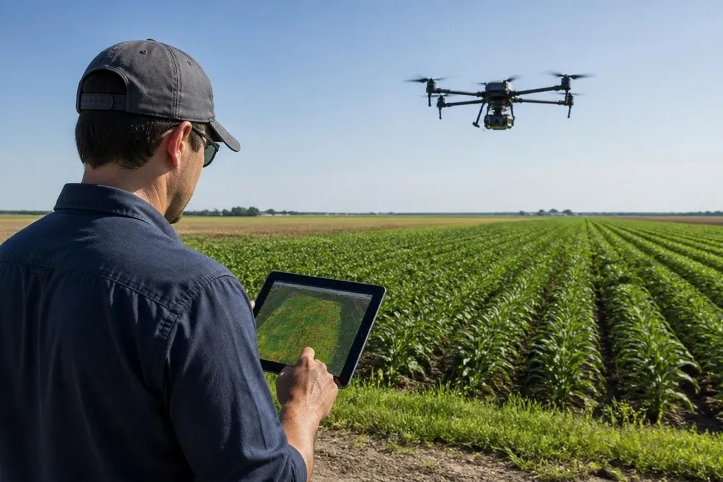
A farming drone can scan a field in minutes, but the useful part starts after the flight. AI software turns images and sensor readings into maps that can help a grower find crop stress, plan a closer check, and send work to the right part of a field.
Quick read
- AI sorts drone images into crop, soil, weed, and damaged areas.
- Better maps can reduce blanket spraying and guide field checks.
- Results depend on image quality, crop knowledge, weather, and a clear next step.
From flying camera to field map
A drone collects images as it follows a planned route. A camera may record normal color, while another sensor records light outside the range people can see. The software compares those readings across the field and marks areas that look different.
That difference does not prove a crop problem. Dry soil, shade, plant type, disease, and uneven growth can create similar patterns. The map points a person toward a location that needs checking; it does not replace that check.
AI can also sort images faster than a person working through a large set of photographs. It may group plants by size, mark gaps in a row, or identify patches with signs of stress. The exact task depends on the crop, the training data, and the software settings.
Where the information helps
A map matters when it changes the next farm task. A grower might inspect a marked area on foot, take a soil sample, adjust irrigation, or send a sprayer to selected sections instead of treating the whole field.
That approach can make field work more focused. It can also create a record for later comparison, so a grower can check whether a patch improved after water, fertilizer, or pest control changed.
The drone itself still has limits. Wind, cloud cover, flight height, camera angle, and timing can change the images.
A flight after rain may show a different pattern from a flight during a dry period, even when the crop has not changed in the same way.
Farm operators still need to compare a drone’s flight record with crop maps and weather before acting on an AI recommendation. Robot24.com’s robotics coverage for farm work can place those machine results beside the field conditions that shaped them.
AI does not remove farm judgment
The hardest part is often deciding what a map means. A red patch on an image may show a real crop issue, or it may reflect a low point in the field where water collects. The software can find the pattern, but local knowledge helps explain it.
Training data also matters. An AI system trained on one crop, region, or camera may perform poorly in another setting. Changes in plant variety, soil color, sunlight, or growth stage can affect the result.
I’d treat an AI map as a work order for inspection, not as a final diagnosis. That keeps the system useful without giving a color-coded image more authority than it has earned.
The same rule applies to automated spraying. A drone can mark a treatment area, but the farm team still needs to check chemical rules, wind conditions, dosage, and whether the target is present. Flight planning and crop decisions remain separate jobs.
A practical buying checklist
Before choosing a farming drone or AI service, check these points:
- Name the task: Decide if you need crop counts, weed maps, stress checks, or another defined result.
- Check the sensor: Match the camera and flight setup to the crop and the signs you need to see.
- Ask about training data: Find out which crops, regions, and growth stages the software has covered.
- Test the handoff: Confirm that a map can become a field visit, sample, irrigation change, or treatment plan.
- Plan for repeat flights: Use the same route, timing, and image settings when you need to compare results.
The right system should fit an existing farm task. If the map cannot guide a decision that someone can carry out, another dashboard will not fix the problem.
The next useful measure is not how many images a drone collects. It is whether those images help a grower find problems earlier, inspect fewer unneeded areas, and act with better information before the crop loss grows.